
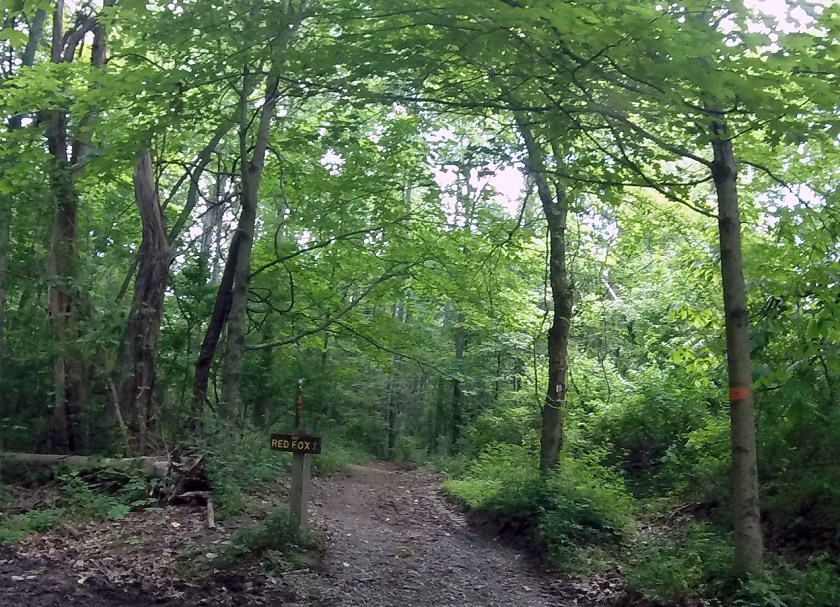
Featured image: This freeze frame from a GoPro video is of one of the trails that cross the bridle trails in East Fork State Park near Batavia, Ohio. The park has 46 miles of uncrowded, backcountry trails – not including bridle and bike trails – ripe for the hiking.
The first time I announced I was going to East Fork Lake State Park in Clermont County, Ohio, the response I got was a look of bewilderment.
“Ew. Why?” was the question that went with the look.
What I didn’t know before my first visit some five or six years ago is that the lake the park is named for is known for being kind of gross. It’s one of those man-made lakes that was created to help curtail flooding. The dam was built and the lake filled – covering everything left behind in water, including buildings, bridges and whatever else trash was left behind.
The gross part is the lake issues warnings periodically because of a toxin created by algae in the water. Some level is safe, but as recently as last summer park officials had to issue a warning for people who are very young, very old or have compromised immune systems to stay out of the water. Nevertheless, the beach stays busy but not overcrowded, there is a new bathhouse (that actually has doors) and a boat ramp. Oh, yeah, there’s also 46 miles of backcountry trails, and miles of bridle and biking trails that allow hiking. For all these miles of trails, I can deal with a dirty lake, moss-covered ponds and and random, rusted-out hot water heaters tossed out on a trail.
I probably make this park sound much worse than it really is. For the record, the first time I went to the park, I went only to the beach, played in the water and didn’t die. I’d never do it again, but that’s because I have a “compromised immune system” – a.k.a. I take drugs to beat down my immune system so it doesn’t kill me. So even if there is no health warning posted, you won’t find me dipping a single toe in that water. Now, if I could just keep my dog from drinking from stagnant pools – and then subsequently yakking everywhere – I’d be in business.
What trailheads?
The second time I went to this park was earlier this summer. Lacey and I headed out one Sunday afternoon with the intention of logging some miles. We got to the park and an hour or so later, we actually got on a trail. Which brings me to my only real complaint about this park: It’s next to impossible to find a trailhead.
If you enter the park from the State Route 125 side and stop at the Visitor’s Center, there is a kiosk outside chock full of completely useless maps. Roads aren’t named, they’re numbered. But matching up the road you’re on with the road on the map is nearly impossible. The only trail that was easy to find is the backpacker trail. It’s on the right, just past the visitor’s center. Parking is to the left, just past the putrid pond. The trailhead in the parking lot is the start of the mountain bike trail, which also allows hiking.
Part of our problem was that the trail rating on the map listed the backpacker trail as moderate/rugged and I wasn’t feeling particularly rugged that day. So instead of just hiking the trail we could find, we spent an hour trying to find the trailhead for one of the shorter, easier trails, which we never found. But we did find the trailhead for the bridle trails on the State Route 32 side of the park, and hiked about four miles on them.
Bridle Trails

For anyone else, I’d rate the bridle trails as easy, but they can border on moderate with busted lungs. The trails are almost flat and have few obstacles in the way.
There are one or two obvious problems with bridle trails: Horse patties and trail damage. Couple that with the wet summer we’ve had and if you’re not picking around one you’re picking around the other. Even still, there was usually enough room to walk around or pick up a spur to the side of the trail to bypass the mess.

This is another freeze frame from a video, so please excuse the quality of the image. But you can see the kind of trail damage you’ll cross on the bridle trails.
These trails were almost completely flat. If you’re looking for a good trail and you want a quiet walk without having to go up and down a bunch of hills or climb over fallen logs, take a tour of the bridle trails. We passed a couple of riding parties, but that was about it. There are several trails that intersect with the main bridle trail, so if you get bored with what you’re seeing, just take a side trail. We took several, I can’t even remember which blazes we followed, but none of them disappointed.
Backpacker Trail

A step up on intensity from the bridle trails, the Perimeter Trail borders on rugged for the busted lung club. The hills aren’t very difficult but they are frequent, and there are roots, rocks, creeks and fallen trees to navigate along the way.
The third time I went to this park was about a week ago. I was coming off a couple of weeks of zero days and out to prove a point. My goal at the beginning of the summer was to be able to hike eight miles – my pre-diagnosis best for a weekend day hike – and I was determined to make it. (Spoiler alert: I didn’t make it.)
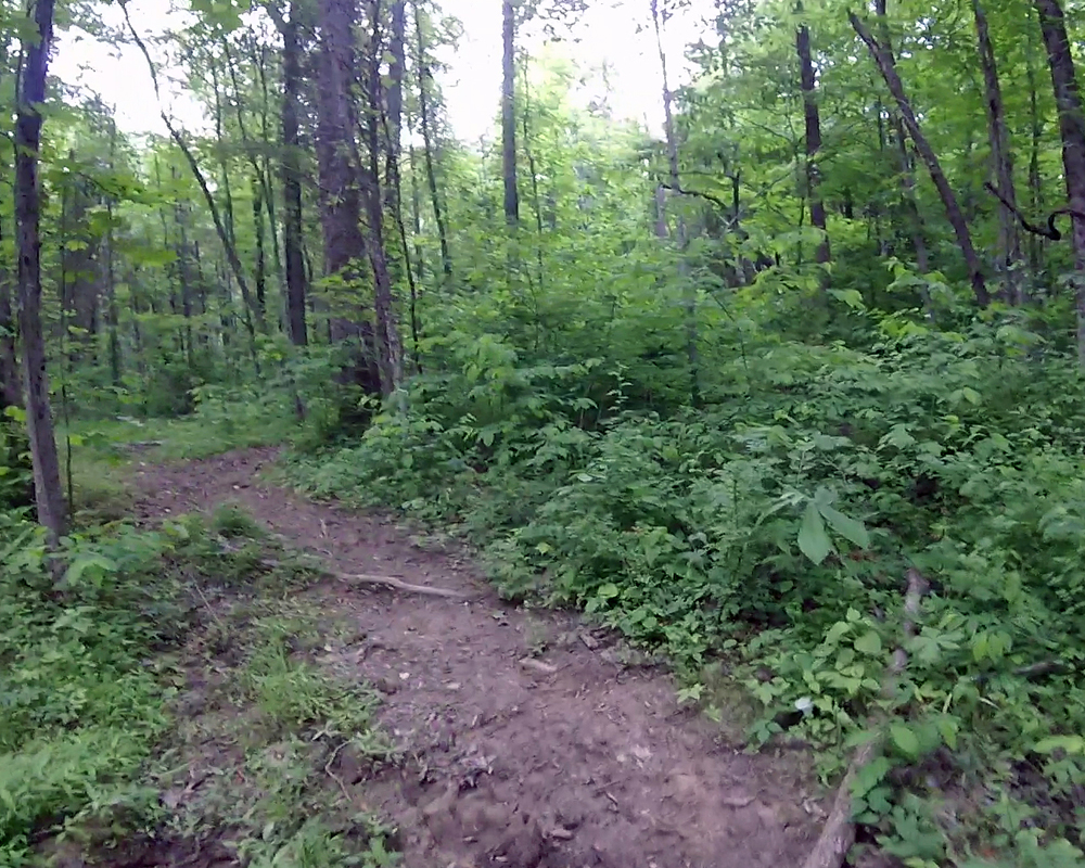
This is a freeze frame from a GoPro video, so please excuse the image quality. But this is a piece of one of the trails that cross the bridle trails at East Fork. This is what most of the trails I’ve seen look like.
Lacey and I hit the park, and this time I didn’t let the moderate/rugged tag scare me. In fact, we were about a mile and a half in when I declared that the trail wasn’t that bad – and it wasn’t, really.
If you park at the lot behind the putrid pond and then walk back out across the road, you’ll find the Steve Newman Worldwalker Perimeter Trail. This 32-mile trail circles the park and has four primitive camping sites along the way. I’m not so sure the campers who used the spots believed in packing out their trash, because it was partially bagged and left in the fire pit. I guess at least it wasn’t strewn about the site?
The trail winds around and over some smallish hills, through some narrow, mostly dry creeks, and over some fallen trees. It isn’t nearly as easy as what we walked on the bridle trails, but even I still wouldn’t consider it rugged. We hiked out about 2.5 miles before my lungs started betraying me and we turned back. Our total for the afternoon was 5.1 miles, and even though that’s not a lot, it ain’t too shabby for some busted lungs.

Pingback: Out with a bang |