Latest Posts

Leafy-green mountain majesty

I remember my sixth-grade teacher telling a story about a college roommate from one of the plains states. When they got to our rolling hills of southwestern Ohio, they were incredulous.

“Are those mountains?” they wondered. Obviously, I have no way of verifying this. But my teacher swore they thought our hills and ridges were mountains because the geography they were used to was flat as a pancake. I wonder what they would have thought the first time they saw actual mountains – like the Great Smoky Mountains. I grew up bouncing up and down hills – carsick half the time – and I was incredulous the first time I saw a real, live mountain.

My first trip to the Smokies was in 1998. My family – aunts, uncles, cousins and grandfather – rented a chalet in the mountains for Labor Day weekend. It was the first time we experienced the stop-and-go traffic of the Parkway and the fervor of Tennessee Volunteer fans. I was 13, and when the adults went to bed, my cousins and I had the run of the place. It was fan-freaking-tastic.

This slideshow requires JavaScript.

But the mountains – they were the show stopper. The first night there, we got in after dark and had to feel our way through the switchbacks to get to our chalet. We got turned around a couple of times, but we managed to get there without going over the side of the mountain. By the time we arrived, if our ears weren’t popping, we wished they would.  We couldn’t really see anything until dawn broke the next morning. Once everyone started getting up and looking out the windows, they were amazed.

My family visited the Smokies several times before we decided to go West to see the Rocky Mountains. Let me tell you, once we saw those towering, rugged, behemoths, well, the Smokies just didn’t seem all that grand anymore. Poor Smokies. I suppose older mountains are like older people: All the things that make them seem super cool gets worn away until we forget just how spectacular they really are.

It wasn’t until we went down in March, after the fires ravaged the Gatlinburg area, that I got a reminder of just how majestic those smaller, rounder mountains really are. You see, when the fires coursed over the mountains, much of the underbrush burned away exposing the bare rock underneath.

Here on the eastern side of the country, where water is much more plentiful and the elevation is lower, we have dense foliage that grows up between trees. It creates a lush, green curtain shrouding the true majesty of the Smokies. But in the Rockies, the higher elevations and drier climate makes it more difficult for that kind of growth to gain a foothold.

So, while the Rockies display a sort of “in your face!” kind of strength – daring you to try to tame them – the Smokies kept their strength and ruggedness hidden, inviting you in for an adventure. That is, until a fire burned away its shroud and reminded me that just because these mountains do not tower over 14,000 feet, they are no less majestic.


Check out my YouTube channel for additional video content of driving through the mountains!

What does remission look like?

Almost as quietly as Sjӧgren’s Syndrome caused my immune system to creep up, nearly turning my life upside down, I slipped into remission. More importantly – I’ve stayed there for one year. I didn’t even realize when, exactly, I went into remission until last month when Dr. B said, “It’s been a year!” (Cue balloon drop.)

So what does that mean? It means that if my immune system stays beat down for another 12 months, I get to start a painstakingly slow drug taper. Maybe, in another five years or so, if all goes well, I can be medicine free! In the meantime, it means I live.

The last couple of years have felt like war. I was diagnosed in 2014, and I was at rock bottom. In 2015, I was out to prove that my life wasn’t over and I pushed and scraped and fought for every breath for every step I took. Last year, I settled in a bit. When my body stopped trying to kill me, I stopped trying to kill it. We learned to work together again. It wasn’t an easy lesson. I’m stubborn, after all. But after a particularly humid hike, in which I ran out of oxygen, literally brought me to my knees, I realized the only way forward was to accept the things I cannot change.

So, you’ll notice that there aren’t as many posts about hiking anymore. That’s not just because I took a sabbatical over the fall and winter. It is because when it’s hot and humid or too cold, I don’t go – or I just go a short distance. I adopted other, lower impact, outdoor activities. No joke, I garden. It started off with just some flowers on my back patio last year. No matter how hot or humid it was, I could always take care of my little container garden and enjoy bursts of color all around me.  This year, I might have gotten carried away.

Keep in mind, I rent. It’s a relatively private townhouse, but I can’t exactly go tear up the grass or anything. Meticulously arranged between my shared front porch and private back patio, I’m growing strawberries, tomatoes, cherry tomatoes, corn (heck, yes! I found corn you can grow in a pot!), and six or seven different varieties of flowers.

What? I don’t believe in doing anything in half measures. It’s going to be beautiful – and tasty.

More importantly, my life is kicking back into gear again. I’ve held myself in limbo for the last couple of years, putting career and educational aspirations on hold while I figured out what I am still capable of. I’m moving past letting an autoimmune disorder (and subsequent lung disease) define everything I do. This is what remission looks like.

Imma Back!

I may have recently spent a four hour car ride playing Mario Run, and am now beginning to talk like a fictional Italian plumber. Also, I suck at video games. I keep playing but I never get any better! Kind of like blogging … oh, wait. I don’t keep blogging. I just pop in a couple of times a year lately and say I’m going to blog regularly and never actually do. The evidence would suggest I also suck at blogging.

It isn’t that I haven’t had anything to talk about, exactly. My adventures have been just few and far between. Hiking has turned into something I squeeze in here and there at a park near my house so my hound dog can get out and smell something other than our backyard. Marcel Proust said, “The real voyage of discovery consists not in seeking new landscapes, but in having new eyes.” Well, Proust, I took new eyes to my local park, but I ran out of pairs after about the tenth trip. Between last summer’s overwhelming heat and all the extra hours I’ve been working on weekends, I’ve gone back to a pretty boring routine.

But guess what? Summer is coming. (Take that, Starks.) I’m sweeping away the cobwebs and getting some adventures planned. Because, really, if I don’t start doing something again, my soul is going to wither and die. That’s rather dramatic, I know. But I have a feeling if you’re reading this blog, you know exactly the feeling I’m talking about. Plus, I need something to distract me from graduate school applications. Otherwise, I’ll keep imagining the review board members reading my essay, laughing and then passing it around to other departments so they can laugh, too.

When I planned to start blogging again in the fall, I had about 10 posts outlined, several of them for trips that have still yet to be taken. I plotted routes to Lake Erie, Lake Michigan and a half-dozen other parks and historically interesting spots around Ohio and Indiana. Then I stopped to think for a minute; there are so many interesting things right in my own backyard. And then I thought, “Cassie, why didn’t you think of all these things over the last few months?”

Over the next couple of weeks, I’m going to polish the old stories that have been languishing in my blogging folder. I’ll work out the kinks on topics such as breathless-friendly hikes in Hocking Hills and how Mammoth Cave changed the way I see the Earth. And then, my friends, we’ll embark on something new.

Craving more adventure between posts? Check out Instagram @BreathlessAdventurer.

Happy 2nd Anniversary!

Well, hello there! I’ve been gone for a while, but I’m back now and ready to get hiking again! It’s been, what? Six months now?  I quit right after I was supposed to really start making a dent in that 52 Hike Challenge I started at the beginning of the year. But that wasn’t entirely me just letting other projects/life events get in the way. It was mostly Mother Nature and my lungs ganging up on me for basically the entire summer.  But guess what? It has been 113 days since I needed to use Gus!

My relationship with my oxygen has been like a bad romance. We get along great for a while, then he cramps my style. Then I remember I need him, but I don’t want him anymore. Until this summer, I couldn’t live with him, but I couldn’t live without him. Then one day, after a particularly difficult stroll in the park, I realized I can, in fact, survive without him. (Keep reading … you’ll get the full story.)

I really didn’t have much to talk about this summer. Thanks to humidity so high you walk outside and drown, I got benched for a while. What’s that you say? I never let weather or it effect on me stop me before? You’re exactly right! I hadn’t – until a sunny day in June. Let me tell you a story about the day I finally said, “Uncle.”

When I last blogged, I was still on my springtime high – super excited that it was finally warming up and things were turning green again. Last summer, my hiking season stayed strong until mid-August, and I never thought that this year wouldn’t be the same. Well, dear Mother Nature forgot to take her Midol for about three months and hit us with the kind of heat and humidity the weatherman says people with breathing problems should avoid.

Did I listen to him? Psh, naw. Why would I do that? I like to learn things the hard way.

I tried to power through. Yeah, sure, I can still play outside when the heat index is over 100 degrees, but my lungs aren’t going with me. In a classic Cassie move, I thought I could handle a 7-mile walk around a park. I mean, it’s one of those multi-use paved trails. Easy, right? Ha. Hahaha. Hahahahahahahaha!

The trail runs between stands of trees, but it isn’t actually shaded. We were walking on blacktop with the sun bearing down on us. It was fun for about the first mile. After that, the plodding started. I refused to give up, dug in and turned my oxygen up. And I started getting really cranky. I’m used to people staring at me. I know I look like a weirdzilla with tubing wrapped around my face. Usually, I just smile and keep on walking. But on this day I had zero patience for adults who should have better manners. So I started snarking at people when they’d stare as they walked by. Not my finest hour. (Sidenote: Adults have corrected their children for staring at me while they are doing it themselves. And for the record, I don’t mind kids staring at me. It give me the opportunity to tell a white lie and say this is what happens when you smoke, so don’t ever start! Also, for the record, I have never smoked.)

We would get to a marker and I would say, “Just a half mile more and I’ll stop.” I thought I could half-mile my way around the trail.  We turned back when we thought we were a mile into the trail, but we miscounted and were closer to a mile and a half. I was almost through my water and halfway through my oxygen when we turned back. I completely ran out of oxygen about a half a mile or so from the trailhead. It supremely sucked. But, with any bad experience, there are lessons learned.

First, I realized oxygen really wasn’t helping me much anymore. It’s not that my lungs couldn’t use the boost, as they just reach a point when it doesn’t make much of a difference anymore. So even though running out of oxygen for the first time ever was kind of terrifying, it showed me that I can get along without it. I mean, slowly and leaning on everything around me, but I can do it.

Second, I realized that I really need to pay more attention to those weather warnings and stay the heck inside sometimes. And even though I’m having a good time picking on myself for this choice, I’m glad I did it. I can’t go so far as to say it was fun, but I’m proud of myself for completing almost four miles of trail in a 110-degree heat index.

Third, but not the least of all, my friend proved for about the billionth time how awesome she is. Even when I was fighting back tears of frustration, she never stopped encouraging me. It seems like the less I believe in myself, the more she believes in me.

After that day, I realized that summers like this one are going to mean that I’m not hiking much. I spent a few weeks feeling really sorry for myself, and thinking I was doing the very thing I swore I would never do in letting this dictate my life. But just because I can’t walk seven miles in the heat doesn’t mean I’m beat. It just means I have the opportunity to do other things I enjoy. Like kayak on a lazy river where I can float when I need to rest and jump in when I need to cool off. My big hiking season is going to be winter. The cold never bothered me anyway.

Hike 8: Appalachian Trail

DSC_6891

I did it, folks! I finally started hiking the Appalachian Trail! I just decided there wasn’t anything to do but to do it and started out!

That’s a total lie. There’s not a bone in my body with enough spontaneity to ever seriously utter those words about anything except ripping off a Band-Aid.

But I did – FINALLY – knock out my first section hike.

It was about a 100-feet-long section – but it was still a section so shut your mouth. Also, I did it without oxygen. Yes, it was 100 feet on a road atop Fontana Dam, but I DID IT, darn you.

So saying I completed a section hike might be a bit of a stretch.

I read somewhere once that if the water levels in Fontana Lake are low enough, you can see the old roads that were flooded over. We didn't find them.

I read somewhere once that if the water levels in Fontana Lake are low enough, you can see the old roads that were flooded over. The water was still quite low, but we didn’t find anything but dirt.

My Hike Eight is a bit of a cheat, but I couldn’t help but throw this in here. The day we hit Juney Whank Falls, we kept driving around the area. I’m not really sure how or why, but we ended up at Fontana Dam.

Last year we came close to it when we visited the Road to Nowhere. We drove up hoping the water level would still be low enough for us to see some of the old road that was flooded out, but we either weren’t in the right spot or the water was already over it. Nevertheless, I checked out the giant Appalachian Trail board outside their visitor’s center and we all walked around the dam.

100 feet down. 11,447,040 to go.

Hike 7: Juney Whank Falls

And now, for a hike outside the Ohio, Kentucky, Indiana tri-state area! Its been a while since I hiked more than 50 or so miles from home, but on my family’s annual spring trek to the Smokies I managed to talk them into a hike – however short it was.

IMG_3654

It was mother/daughter selfie time with a quilt about one of our favorite movies!

Every year there is a quilt show in Pigeon Forge, Tennessee, for which Mom basically offers my brother and me a free trip. I go with Mom to the quilt show and Cory (my little brother) goes with Dad to do manly-man things. Everyone wins – including me because I get to look at something pretty and say, “Mom! Make me that!” Usually, she will.

Last year, the boys hiked somewhere and found and old, forgotten graveyard. When I tried to get them to take me to it the next day, they claimed they couldn’t remember where it was. This year, while Mom and I wandered through convention center displays, they bought tools and then went back to the hotel to sleep. Basically, it was their usual Friday.

DSC_6780

So now you know where I get my goofiness from. Dad was feeling rather victorious after tackling the switchbacks of the quarter-mile trail.

Saturday broke a rainy, gross, cloudy day. But by the time we got through a hearty, southern breakfast, the sun was chasing the clouds away and I managed to talk everyone into going waterfall hunting. I thought I found a relatively easy hike, even for my broken lungs and my parents’ old knees. But like everything in the mountains, looks can be deceiving.

Mom found a copy of The “Smokies Guide,” the self-proclaimed official newspaper of the Great Smoky Mountains National Park, somewhere and the “Places to go” section listed a couple of places I haven’t been before. We decided to choose a place none of us have been, and headed to Bryson City, N.C. to pick up the road to Deep Creek.

DSC_6772

The Deep Creek area is full of waterfalls. This Barbie-doll sized set of rapids is the first one you’ll see when you leave the parking lot.

I’ve been to the Gatlinburg and Pigeon Forge area of the Smokies more times than I can count. The mountains in that area haven’t lost their majesty, but the traffic and the crowds certainly have. The last few times I’ve gone down, I’ve spent most of my time on the North Carolina side things. It’s not necessarily always less busy, but there at least seems to be more places that aren’t completely overrun with tourists.


The “Smokies Guide” calls Deep Creek off-the-beaten-path – and it definitely was. We passed through a holler outside Bryson City that looked like the kind you didn’t want to break down in, if you know what I mean. Right about the time my parents pointed this out, I realized this was just the kind of spot I wanted.

DSC_6770

This always makes me sad.

Although the Park Service advertises Deep Creek as one of the few areas in which mountain bikers are welcome, we didn’t see anyone on bikes. Just a mostly-full parking lot and several off-season couples and families wandering about. I’d say that even though the area is a bit off the main drag, it still gets very busy in the warmer months.

There are several trails of varying length and intensity in the Deep Creek area, and we chose the shortest one because no one enjoys being outside as much as I do, and my parents have old joints. Juney Whank Falls is the easiest to reach, but you climb about a quarter-mile of switchbacks to reach her. Once you reach the falls, the trail divides to go above and below the falls. You can either take the trail past the falls further uphill to loop back around to the parking lot, or you can turn around and take the devil you know back down to the car. We took the devil we knew and went directly back downhill.


GusScaleLvl4

I’m giving this trail a solid middle ranking. It’s a very short, very clear and well-kept trail. By that I mean you won’t be tripping over rocks and roots. But it is almost entirely uphill, so be prepared for your cardio when you hike this trail.

The hike was short, but pretty. It was also not a hike I should have tried without Gus; my oxygen level dropped to 78 before I sucked it up and plugged in. After that, my rest breaks got farther apart than about every 15 feet.

If you want to go farther on the hikes, the North Carolina Waterfalls site has a lovely post that takes you farther along the Juney Whank Trail to show you the other two waterfalls in the Deep Creek area: Tom Branch Falls and Indian Creek Falls.

Hike 6: Look, Ma! No Oxygen!

I’ve really been sucking at this whole 52 Hike Challenge and blogging thing this year. I can’t seem to get myself in any kind of groove. Basically, if I had a three-day weekend every weekend and zero other family/life obligations, this would be a lot easier. But, my creditors don’t care if working overtime kills my soul, and so I’ve been losing a lot of Saturdays to The Man. Nevertheless, I’ll keep plugging away.

So, depending on the order in which I publish the posts I’ve been working on this sunny, chilly Sunday afternoon, and if you choose to read them all (I wouldn’t), you’ll know that no longer using oxygen is finally on the table. It’s taken about six months of me rarely using Gus other than when hiking, of course, to get Dr. M. to consider this. That being said, with my pessimistic doctor finally on board, I’ve started considering what that actually means.

new-mad-max-fury-road-trailer-shows-no-mercy

The second I saw this guy in “Mad Max: Fury Road,” I knew this is what I have to look like when I’m hiking – oxygen and crazy written all over my face. Except, instead of a huge gun, I have a rabid hound.

Might I hike without my “Mad Max” backpack of oxygen on my back? I decided to find out.

I went to a trail I knew well. Any ideas which one? Yes! Big Bone Lick SP. I suppose I could have walked around my neighborhood first, but, let’s face it. That’s boring. And my dog hates all our neighbors. So I decided to hit the easy-peasy paved trail at Big Bone.

It was great. Sometimes longer distances can start to wear my ol’ lungs down, but this wasn’t an issue, thanks to intermittent stops for my hound dog to inspect a clump of grass. Or a leaf. Or the wind. This path is basically a flat walk around a bog and sulfur spring (peeee-youuuuuuuuu), so I wasn’t expecting anything to be a huge issue.

So, since I was doing so well, why not push things a little? We headed off on a side trail I knew would take us up a slight incline to the bison pen, then dump us downhill before a final climb over a moderate hill back to the parking lot. I know how I usually handle this trail with oxygen, so I had a good baseline on which to compare results.

The inclines got a bit hairy at the end and that last incline got me down below 88 – my danger zone – but I was able to either slow down or stop to get my oxygen level back up again enough to finish the short hike without busting out Gus.

I call it a win.

Happy Hiking Anniversary!

About this time last year, I decided I wanted to start hiking again. So, I took a vacation day and did just that, attempting two hikes for my first foray into the woods. About five months later, I was still hiking about every week. In fact, I was so dedicated Dad felt it was necessary to sit me down for an intervention. It was a hot August day.

“It’s like an obsession with you lately,” he said, eyebrows drawn over baby blues, forehead creased with worry. He was rubbing his palms together, doing that thing he does when he doesn’t know how to ask whatever burning question he has that day.

“Why do you feel like you have do to this?”

That was a great question. And by the time he finally sat me down to ask it, I knew the answer.

I’m going to pause for a second to admit I feel sometimes like I take this Sjogren’s thing a bit too seriously. Especially since most people I’ve encountered – either online or in person – act like it is no big deal. And they’re right. Sjogren’s typically isn’t. It’s not cancer or Lupus. It’s typically just an annoying thing you deal with. But when it causes your immune system to try to kill your lungs, it becomes a very big deal.

So when I started hiking again a year ago, after six months of barely being able to walk across the room without stopping to rest halfway, it was a big effing deal. I had a lot of fight in me the year before, making it as long as I did before I finally gave up and went to the ER. (My rheumatologist likes to bring this up frequently. He always says it a little in awe and a little reproachfully, warning me not to do it again.)

For a while, that fight was gone, but I think it needed to be. My body needed time to rest and heal. But that time ended a year ago when I completed my first hike. Walking even just a mile with Gus cranked up to full power was a hard won battle – and I got addicted to the feeling of power I got when I finished.

I finally believed Sjogren’s and Interstitial Lung Disease weren’t going to beat me. I had found my fight again.

But there was another reason for my constant wandering last summer: I wanted to. Again, I know I wasn’t given a terminal diagnosis or anything. But still, I got a wake up call. I went through my 20s working nonstop and trying to finish my degree, rarely stopping to just enjoy life. I kept thinking that I’d work really hard and pay my dues to society, then start traveling and enjoying my life. I had things so backwards.

Flash forward. I’m 29. I’m in the hospital. I have two busted lungs. I’m put on medicine to suppress my immune system. I’m on oxygen, presumably for the rest of my life. I’m trapped like a docked boat. The entire ocean is ahead of me, but I have no way to get away from the shore.

So the wake up call: I had put off doing what I enjoyed in favor of a better-paying job, or more overtime, or another internship. At 29, I was still finishing the degree I had started eight years before. I hadn’t done any of the travel I wanted to do, and suddenly, I was sick. Not just sick – I had a chronic disease.

It took six months after my diagnosis for this hit me. Instead of spending any more of my life doing the things I felt obligated to do, I decided I was going to do the things I wanted to do – hike, and explore and travel. And while I’m still working on that world traveler status, my little adventures around home keep me satisfied for now.

So the answer to Dad’s question was simple: Because I can.

In October, about a year after my initial diagnosis, Dr. B. declared me in “medical remission,” which means remission with the help of medication. He also dropped a bomb on me that I wasn’t expecting: I may not have to take medicine to control it my entire life.

I’ll swear on a stack of Bibles that is not what he told me in my first hospital follow up – but it was the best news I’d heard in a year. After spending the previous six months beating myself up for being so-called responsible in my 20s and wasting the “healthy” years of my life on working, he was handing me back several of my goals. The trick for me is going to be staying patient for the next three to five years it takes to wean off my medication and not throw a world-class tantrum if the Sjogren’s rears its ugly head and I have to start all over again. But there’s hope – and sometimes that the best thing.

The good news doesn’t stop there, folks.

There’s also a chance Gus and I will be officially divorcing. I know, I know. I’ve said this before, but this time I mean it! This time, the doctor is finally starting to agree with me.

With my last pulmonary function test, my lungs were at 67 percent function, up from 62 percent six months before. Even to me, that doesn’t sound like that much of an improvement, but I’m still improving – even after my immune system is under control. My doctor is finally ready to admit that I may not need oxygen forever. (It’s only taken him 18 months to come around.)

I’d be foolish if I didn’t at least admit that while I rarely use oxygen for anything anymore, I still need it for anything cardio-related. I absolutely cannot do anything strenuous without my oxygen levels dropping to dangerous levels. But guess what? I call that an opportunity. A year ago I still couldn’t do anything without it.

In about six more months I’m going back for another pulmonary function test. In this one, Dr. M. will determine if I still need oxygen. This is my deadline to be able to hike without my crutch. While the thought of losing Gus is terrifying, it’s also opening a huge door. Step one, get off oxygen. Step two, get off drugs. Step three, take over the world!


Hike 5: Kincaid Lake

Typically, I start a hike with a particular milestone in mind.  I want to complete a particular trail or log a certain number of miles. Typically, I end up on a completely different path. Kind of like life, right? You start out on a path with your entire trajectory planned – if you’re me, anyway – and end up in an entirely different place. Hike five of my 52 Hike Challenge was sort of like that.

It was a breezy Saturday morning. Birds were singing. Curtains were wafting in the breeze. I was blinking into the bright light – of a computer screen.

emme

Seeing a creek without being able to get into it is real frustrating. 

Last Saturday was the first really beautiful day of the year. The temperature made it to 70 degrees, the sun was shining and a perfect breeze was blowing. Why did I shove myself into a corner with a stack of claims to process on such a gorgeous day? Honestly, the prospect of some overtime and extra money was nice. And then the sun lured me outside. But the problem remained: Where should I hike?

And then it hit me – like my excited dog nearly knocking the wind out of me when I get home – why not go back and show Kincaid Lake who’s boss? What better way to kick off the warmer weather hiking season and shake off the winter blues than by revisiting the site of my last 2015 hike?

The last time I attempted this hike it was in the heat and humidity of late summer … and I forgot water. That hike was doomed from the start. This one was different. I had everything I needed for a perfect afternoon out.

emmejpg

Its hard to get a selfie with a tracking dog. 

Emme and I arrived at the park – with plenty of water and oxygen – intending to hike the same route as last summer. (The same hike that is outlined in the “60 Hikes Within 60 Miles” book.) We started down the hill, me letting Emme take the lead. I have a tendency to wander off-trail, while Emme follows the trail of other hikers ahead of us. Hiking with a hound comes in handy when you aren’t sure which trail to follow.

still sign

It kind of looks like there’s a trail straight ahead. We decided to follow it and see where it led!

Once you get down the hill, you hang a Louie at the creek, following it down to a suspension bridge that separates the stagnant piece you just followed with a much prettier, babbling piece of the creek. When we came to the bridge, the hound wanted to cross so she could follow the hikers in the hills above us. It took me about a half a second to override that decision and take a disappearing trail just past the bridge that followed the creek.

Hike 5

The first part of the creek is still and sort of stagnant looking. Farther up, it rolls over a rocky portion of earth. 

Whether this is actually part of the Spicebush or Ironwood Trails that the park advertises, I don’t know. After I crossed the first drainage pipe, I lost all semblance of a trail, but kept following the creek – much to the delight of my water-loving dog. (And no trip around water is complete without Emme nearly dragging me face-first into it.)

We eventually came back out and crossed the suspension bridge. The trail we planned to take went right – following that stagnant part of the creek again before heading up another hill. But going straight took us along the babbling, pretty part of the creek. Guess which way we went?

still sign 2

Not exactly a white blaze, but they mark the trail. Kinda. 

One thing to note about the hiking trails at Kincaid: They aren’t extremely well marked. There are arrows at various points along the trail telling you which way to go, but the trails aren’t often travelled, making it easy to lose track of where you are between the markers. This phenomenon is a little worse right now because we’re still in winter – even if Saturday’s perfect weather didn’t know that.

For much of the trail we covered, the only trace of a path was a barely perceptible dent in the leaves carpeting the ground. I could only see it from a distance, and once I started following it, the wind was the only thing guiding me. That’s how I ended up thinking I was all cool, blazing my own trail, only to look a back and realize that I had been following a time-worn trail all along.

I didn’t face down my nemesis from last season, but I had a fantastic afternoon trying to not get pulled in while my dog played in the creek like a puppy. While a big part of my 52 Hike Challenge is pushing myself harder and tackling more difficult hikes, the bigger part is enjoying the adventure.

Shawnee Lookout: Life-sized Timeline

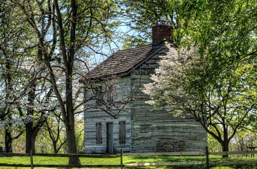
Caption: The lovely featured image of the old log cabin at Shawnee Lookout was taken by Cathy on Flickr. Check out her photo here.

Today, I was supposed to knock out three hikes and make up for some lost time. But, with the temperature in the single digits this morning when I started to head out, I thought I’d rather just curl up with a pot of coffee and get some busy work done. (Hiking in sub-zero temps may be OK with The Real Hiking Viking, but not for Cassie. Though I am enjoying watching his hike progress.) I was going to hike Shawnee Lookout today, but instead I’ll fill you in on some of the history of my second-favorite local park. Then next weekend, we’ll see how my lungs fare on its trails.

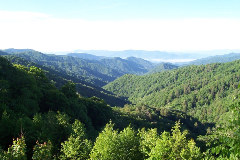
Shawnee Lookout spans a beautiful swatch of land between the Great Miami and Ohio Rivers, less than a mile from where the two rivers converge. Of the park’s three trails, the westernmost trail ventures into the point between the rivers, stopping near the floodplain between the two waterways.

I love to hike here, but it’s not really one of those places you can hit up and hope to feel completely disconnected and lost in nature. To me, it’s more of a place where you get a great walk in the woods – and see a life-sized timeline spanning more than 10,000 years.

I’m a long time removed from my seventh-grade Ohio History class, so I’m more than a little rusty on my facts. But, what I culled from dear old Google tells me that there have been more developments in the last 20ish years, so I don’t feel so bad for forgetting most of it. A 2009 study done by University of Cincinnati archeological students showed that Shawnee Lookout could be “the largest continuously occupied hilltop settlement established by any Native American group,” according to an article published in “Science Daily.”  This statement is supported by artifacts found which date back 14,000 years and are attributed to the Hopewell Indians. Some of the more recent studies have shown that the most recent Native Americans to live in the area, the Shawnee the park is named after, are linked to the Hopewell Indians, thus creating this continuous Native American habitation for over 10,000 years.

Let’s take a walk through time.

Miami Fort Trail

22301927921_21494255f9_k

This photo of the valley was taken by Stephen on Flickr. You can view his photo here: https://flic.kr/p/zYKdbD

Even though artifacts have been found in the area that date back 14,000 years, according to the sign at the Miami Fort Trailhead, the oldest part of history you can easily see are the earthen mounds around the park. None are what you might call “plainly visible” because the trails are kept several feet away and trees and brush have been able to grow up around them. Still, several of these mounds are marked along the 1.4-mile Miami Fort Trail as it meanders its way around the mounds and gives hikers some pretty views of the rivers the park boundaries parallel.

Out of the three trails in the park, this one has always seemed to be the most difficult. It starts you out going up a pretty large hill, and then runs you up and over a couple of ridges once you’re at the top. Still, the cardio is worth it for the views you’ll get.

Between the name “fort” and the ridge top location between rivers, I always assumed this was a fortified position used for defense, but that may not actually be the case. Another blogger visited this park in 2010 and wrote that the Hopewell Indians used this hilltop as a ceremonial burial ground, not as a defense post. But a local newspaper published republished Tamara York’s chapter from “60 Hikes within 60 Miles” which said it was used as a strategic spot, so you can decide how you think it was used. I’m not sure if I prefer thinking I’m walking on a fort, or desecrating a burial ground. But since there haven’t been any reports of children in the area being sucked into televisions, I’m guessing we’re safe. (Also, if you’re into history, I’d encourage you to read all of the blogger’s post above. It has more interesting tidbits about the area surrounding the park.)

7058272397_25b5c455c0_k

This photo of the valley was taken by Stephen on Flickr. You can view his photo here: https://flic.kr/p/zYKdbD

Ancient history and modern day have an interesting juxtaposition along the Miami Fort Trail. On one hand, you are following a marked path along Indian mounds, and on the other you have some pretty fantastic views of the river below – and the power plant belching smoke on its bank. This is the first example of how you can’t quite get away from civilization on this hike.

2532123147_01e0debf2e_b

This photos was taken by Just Nora from Flickr. You can view her photo here: https://flic.kr/p/4RKMZD

Little Turtle Trail

After tens of thousands of years, the pioneer settlers showed up. On the only road through the park, just past the Little Turtle Trailhead, lies the Springhouse school and log cabin. Neither were originally located in the park, but both were built in the late 1700s and moved to the park in the 1970s to preserve them. Farewell, Shawnee. Hello, Europeans.

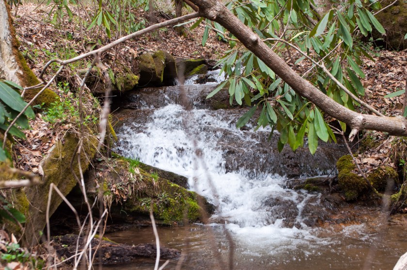
The Little Turtle Trailhead is across the street from the parking lot, just next to a playground. Measuring about two miles, this is the longest single trail in the park. Even though the trail takes you up and around a decent hill, the trail is still pretty easy/moderate for most people. Out of the three park trails, I’d rank it a second-most difficult, behind the Miami Fort Trail. The cool things about this trail are the scenic overlooks along the hillside where hikers can see the rivers below. They’re great places to stop, catch your breath and switch out oxygen tanks.

This trail has little else to remind you of the historical significance of the area. There aren’t any marked mounds along the trails and there aren’t many reminders of modern day unless you get a glimpse of something along the river.

But if you want to take a step forward in time, cross the street for the third and final trail in the park.
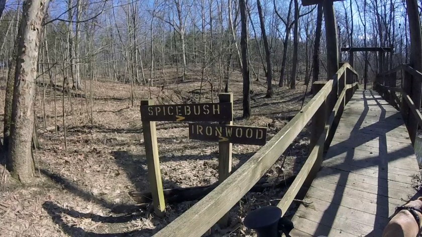
Blue Jacket Trail

I can’t walk this trail without Treebeard from “Lord of the Rings” coming into my head: “They come with fire, they come with axes…. Gnawing, biting, breaking, hacking, burning!”

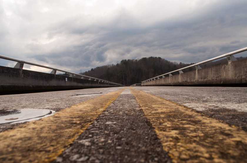
Even though you don’t have the (necessary, I’ll admit) ugliness of a power plant wrecking your view of the river, this trail is bisected by a wide swatch of land that has been cleared for power lines to cut through.

You’ll head into this 1.3-mile trail like you’re on a jolly jaunt into the woods, and start on your merry way. And then, BOOM! You’re in a clearing you think is a cute little meadow or something until you look around and realize there are hulking towers on either side of you and electrical wires buzzing over your head. I mean, I’m sitting here with a computer, cell phone, desk lamp, and various batteries charging, but I don’t want to be reminded of how my own materialism impacts the earth when I’m trying to pretend I’m one with nature. But then, maybe it’s a good thing to have that reminder?

Once you get past the power lines, you’re back into the quiet woods. This trail seems to be to be the least trafficked one, maybe because the only views it has are of trees. There are occasional benches, but there’s nothing to look at but woods – which is better than a power line, any day.