Latest Posts

“Four Boots, One Journey”

Layout 1
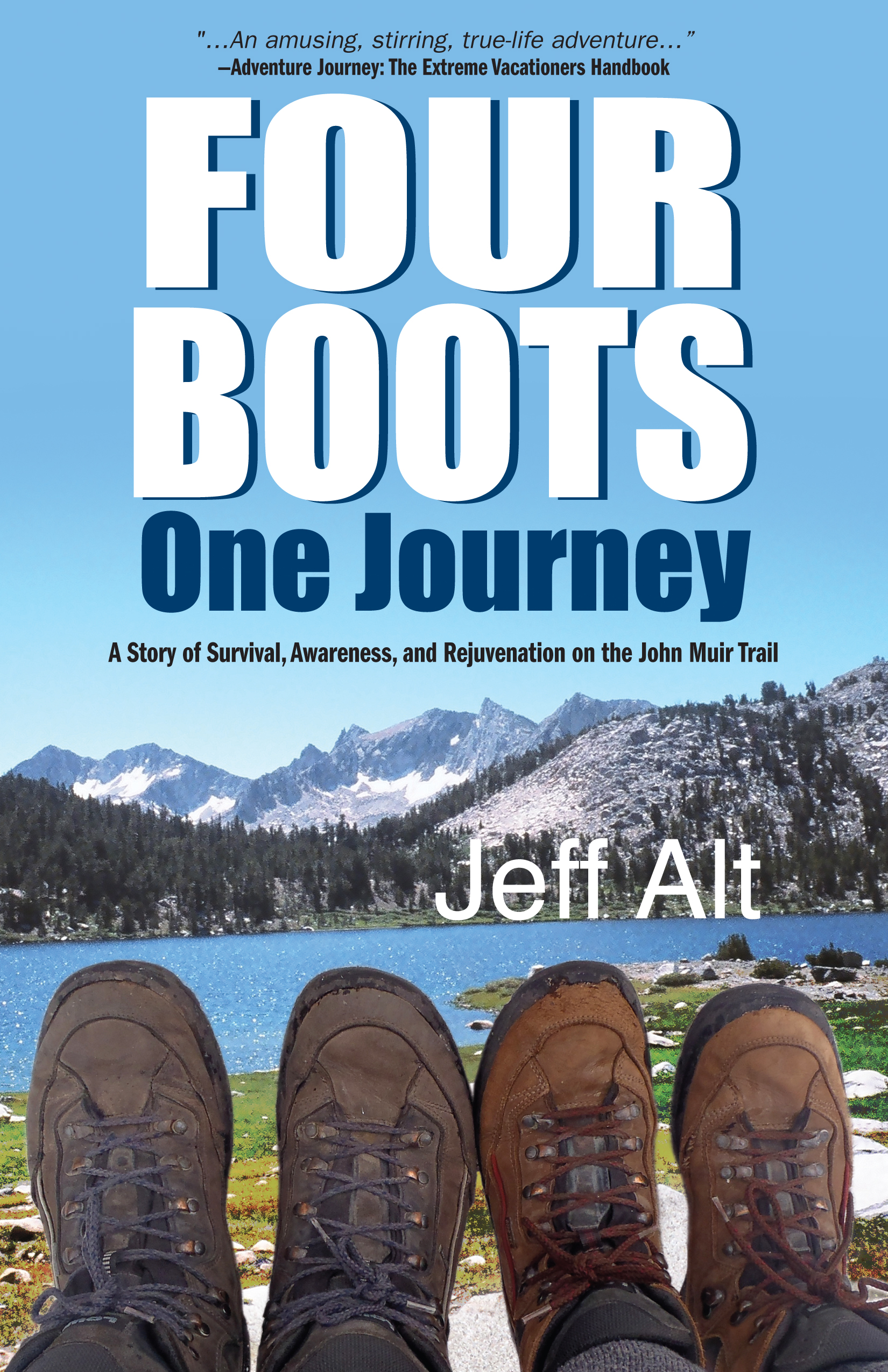
Title: Four Boots, One Journey

Author: Jeff Alt

Short Description: After his wife’s brother commits suicide, the author and his wife embark on a healing thru-hike on the John Muir Trail, a 211-mile swatch of land in the Sierra Nevada that mostly follows the Pacific Crest Trail.

My favorite part: This book has a lot of great information about depression and the JMT.

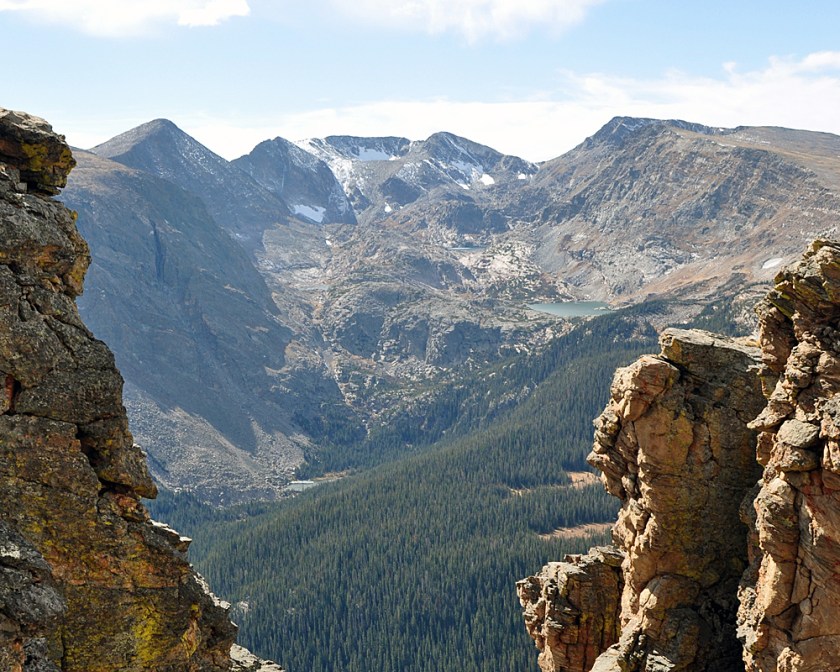
“Four Boots, One Journey” has been on my reading list for a while, and I finally got around to it a couple of weeks ago. What initially got my attention about this book wasn’t the depression awareness campaign that was attached to their hike; it was the fact that they hiked at all. I’m on my annual summer hiking kick right now, and my current obsession is thru-hiking.

Long-distance hiking is something I thought about before I got sick, but now that I know my body is in armed rebellion against itself, I figure if I give my immune system and the rest of my body a common enemy (i.e. huge physical challenge) they can finally unite. (I know, I know. It doesn’t really work that way.)  So I’ve been reading as many hiking memoirs as I can find to get some perspective – and fun stories – about long hikes.

The first one I read was this one, by “Hiker Jeff,” an author and speaker. I get the feeling from his writing that he’s a very practical guy. His writing and descriptions were no-nonsense – by that I mean no fluffy, flowery language and no embellishing of the truth. I appreciate his writing style, even though I’m prone to pontificate and use overly colorful verbs and adjectives for the sake of telling stories. Even without over-dramatization, the funny parts of his story stick out – like when his wife got caught with her pants down – literally – by a park ranger.

Hiker Jeff’s wife wasn’t a hiker, but she promised him when they got married that she’d give it a chance. After losing her brother, she agreed to hike the John Muir Trail with him in an effort to raise awareness about depression and how hiking can help people who suffer from it. Even before their hike began, they started sharing their message about depression awareness to others. Jeff shows us how they raised funds to donate to a charity, gathered sponsors to help them with their hike, and set up a website that chronicled their journey. Sadly, I can’t find this website now; HikeforMike.com redirects to Jeff’s own homepage.

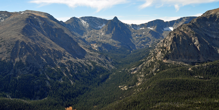
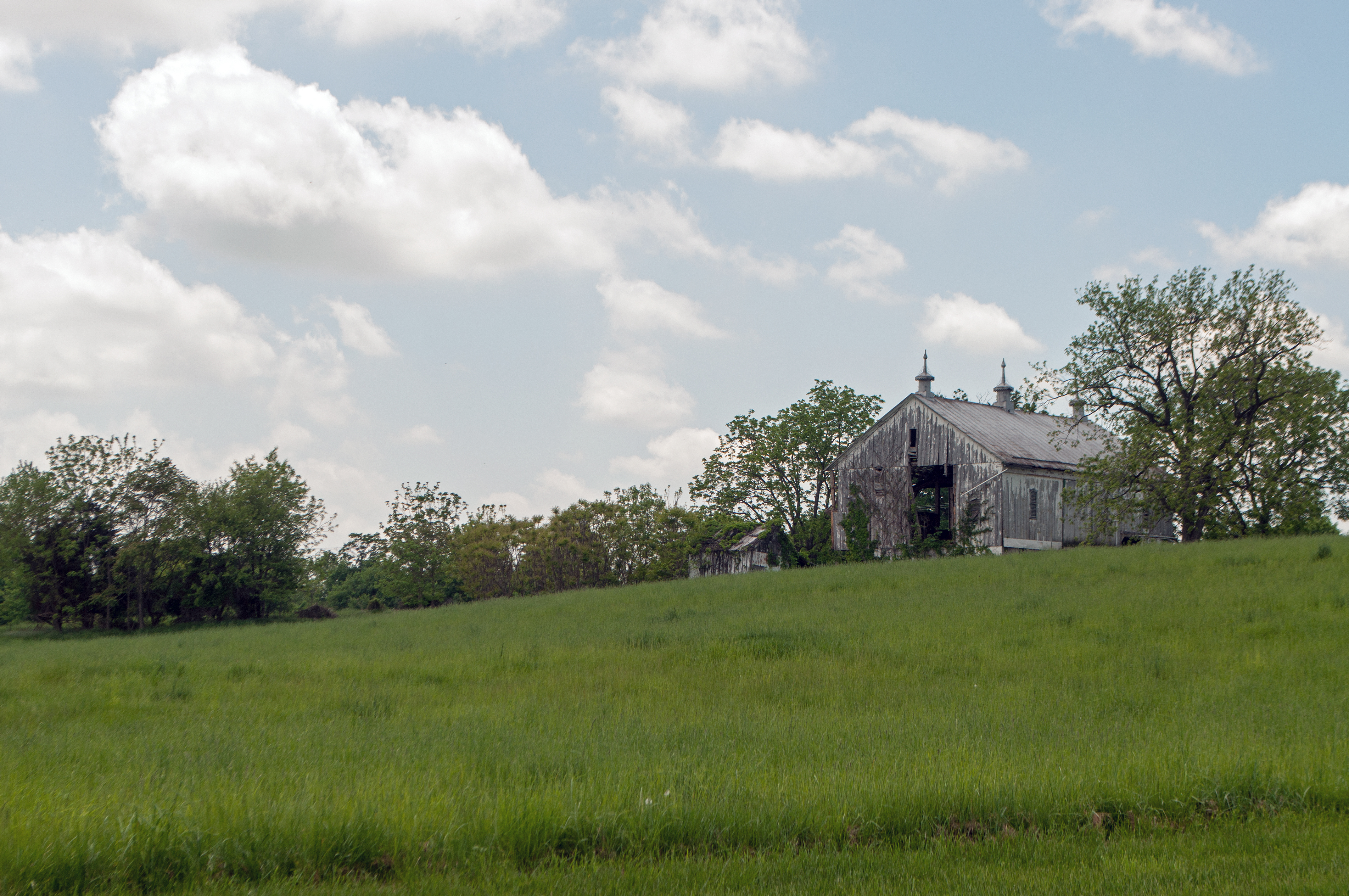
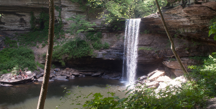
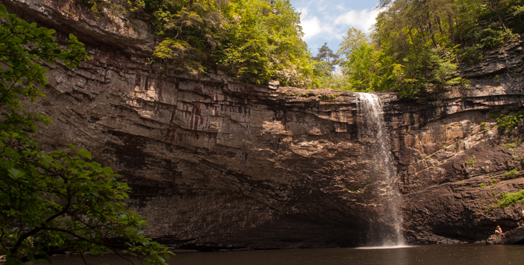
Their journey over the JMT was a healing one for Jeff, his wife and their family. Throughout the hike, he referenced various aspects of grief and depression, tying it in to things they witnessed on the trail. For example, when they crossed the “Golden Gate of the Sierra,” a suspension bridge along the trail, Jeff references the high rate of suicides off the Golden Gate Bridge in San Francisco, and how this bridge in their path only solidified the reason for their journey.

I have close family members who struggle with depression and anxiety, and two of my friends have committed suicide. It’s a terrifying, unfathomable thing to try to understand. Ten years later, you will still wonder what you could have done to help them.

Even though the premise of the entire hike is rooted in a devastating tragedy, it doesn’t overshadow the story. There is still plenty of helpful information about the JMT, how to hike it, places to stay, and the kinds of people you will meet. One of my favorite characters appeared at the end of the story, on the last day of their hike.

When Jeff and Beth ascended Mt. Whitney they passed a woman with whom I could identify. They said she would “take five, small, shuffling steps and stop for a period longer than it took to take the steps.” The couple tried to help her, but she refused, saying she was “just fine.”

I like this woman.

Sometimes when I’m hiking something not nearly as strenuous as Mt. Whitney, I do this exact thing. I’ll move 10 feet and then have to stop to breathe. And I never want help, either. I appreciate the offers, but no thanks, even though I look like I’m dying, I’m doing just fine.

Jeff and Beth met the hiker again later in the day and we learned more about her. This time she was in some obvious discomfort as she rested on a rock, but she explained that her father had many health problems when he died, and she expected she had some of the same.

“But I will get over this mountain,” she told them. “I’ve got all day.” She still kept her sense of humor when she called out after them, “After this trip, I think I’ll stick to car camping.”

I would tell her NO! Don’t car camp — climb another mountain. It will only get easier. Still, I like her spirit. It’s something anyone can relate to – whether you have a chronic illness or depression or just a really bad case of the Mondays.

You can get over that mountain. You’ve got all day.

Breaking up is hard to do

About six months after being told I’ll be on oxygen for-ev-errrrrrr, I’m just a few steps away from breaking up with Gus for good!

About six months after being told I’ll be on oxygen for-ev-errrrrrr, I’m just a few steps away from breaking up with Gus for good!

Gus and I have been having some issues lately.

Things were going really great for us for a long time. I mean, we’ve been together for going on eight months now and we were nearly inseparable. If I left, Gus went with me. Even when I was home, he was never far.

But over the last few months, I’ve been taking some space. Some me time. It’s not Gus’s fault; he’s been great. He’s so supportive and understands when I need some time away from him. But the more time I spend away from him, the more I realize that I don’t need him the way I thought I did. I feel terrible leaving him behind, but he’s still being great. I think Gus always knew that we wouldn’t be forever, even if I wasn’t so sure.

So how am I supposed to dump something that has been so supportive during one of the most trying times of my life?

By calling the oxygen company and saying: “Come and get it!”  That’s right, I’m getting close to getting off oxygen completely!

For the last several months, I could feel myself getting better. My oxygen levels don’t drop as far or as fast as they used to and I’m able to get farther on less oxygen. In January I couldn’t cross the room without it, and even on that I was still short of breath after about 10 feet. By February, I still needed oxygen but I wasn’t losing my breath as quickly.

Then I just got stuck for a while. The weather started improving in March and I was “hiking.” I use the term loosely because I was sticking with easy trails and only going short distances with my oxygen blasting just as high as it would go, and still stopping for breaks frequently.

Then April brought more improvement: I stopped sleeping with oxygen, and within a couple of weeks of that I was only using oxygen when I was walking long distances or wimpy hiking. In a few months, I went from needing Gus around the clock to only periodically.

And now I am just baby steps away from getting the all clear from my doctor to go on as-needed basis with Gus. I had another pulmonary function test, where you go in a little glass booth and blow into a tube for an hour. I won’t have the official test results until next week, but the respiratory therapist was impressed with my improvement.

If I’m honest, I’m doing the as-needed thing already. Since my oxygen levels stay stable for normal, everyday life things such as grocery shopping, short walks with the dog or going to the movies, I started leaving without Gus. Let me tell you, I felt naked the first time I did it. And I spent the entire night with this mild panicked feeling in the back of my mind.

Now that my lungs are getting on the healthier bandwagon, the rest of my body needs to get in line. Even though I’m still weaker than I ever remember being, I can still feel myself getting stronger. I feel different when I breathe. I feel different when I move. I mentioned a while back how much it hurt just to breathe when I initially went into the hospital. That’s gone. Completely gone. I inhale … and nothing. Trust me, you never know how good nothing feels until you’ve felt sandpaper in your thoracic cavity.

With any luck, Gus and I will continue to grow apart. But I hope we remain friends. Someday, I may need his help again, and I’d like to know he’ll be there when I do.

Underground Railroad: Fee Villa

caption

Fee Villa, pictured above, was a stop on the Underground Railroad in Moscow, Ohio. When it was safe for escaping slaves to enter, the residents would signal by placing a candle in the window.

Along the river are a lot of those little blink-and-you-miss-them towns. You know the kind that have a sign saying, “Welcome,” then 10 feet later one saying “Thank you for visiting.” They’re charming, usually hiding some kind of gem – either a great locally-owned shop or restaurant, or someone with a great life story. One thing you can count on is they always have a story to tell.

Moscow, Ohio is a little town like that. If you’re following US-52 – yep, that road again! – you don’t even have to blink to miss it. You’ll see signs for it once you get out of Point Pleasant, Ohio, but you have to turn off the main road to find it.

This teensy town registered 185 citizens in the 2010 census, down from the 244 who registered during the 2000 census. It was in the news about three years ago when tornadoes ripped through the area, taking out about 80 percent of the town and killing three people.

Go back about 150 years and the town was home to a distillery that made fruit brandies, and a glass factory. Today, there are some houses and a church or two. At the end of Water Street is a stately white house standing vigil over a long dock on the Ohio River.

caption

Check out that eerie fog. That’s the Ohio River blending in with the sky there. Usually, its easy to see the opposite bank.

The house wasn’t hard to find, exactly, I just had a bit of trouble figuring out which street I was on. You would think with just a handful of streets it would be easy, which is what I think the village planner thought too because I didn’t think the streets were marked well.

I finally found the house – but only because I decided to drive down a street that ended in a boat ramp because I wanted to get some photos of the river covered in fog. I chickened out before getting to the ramp – I always feel like I’m going to drive straight into the river, even though I’m at least 200 feet from the shore – and when I turned my head to check my mirrors, I saw the small green sign to designate this house as part of the Clermont County Freedom Trail.

This large white house was once a beacon of freedom for people crossing the river. I stood on the bank of the river below the house and tried to imagine what it would be like to get across that river. Its wide and with the heavy fog the morning I was there, I couldn’t even see the other bank. The river and its swift current dwarfed the dock beneath the home.

caption

More eerie photos. I can’t help but love the fog!

The place is Fee Villa, formerly inhabited by Thomas Fee, Jr., a noted abolitionist. When it was safe for escaping slaves to enter, Fee would place a candle in the window of the house. That candle in the window is still used in Moscow’s village logo today.

The Fees would feed, clothe the people they helped, and then transported them along the railroad to Felicity, Ohio.

A few blocks away is an open site where the home of Robert E. Fee once stood.  Fee fought to get back the freedom of a woman and her children who were kidnapped and then sold into slavery. He was unsuccessful, but dedicated his life to helping slaves escape. He was indicted by Pendleton County for slave stealing, but Ohio refused to extradite him to Kentucky to stand trial.

If you want to keep following the Freedom Trail in Clermont County, Ohio, there a many more places to visit. Check out their brochure of Underground Railroad locations, and keep checking back here. I’ll keep visiting them throughout the summer!

TBT: The lake that isn’t there

DSC_8049

This is not a scene from Bonny Lake, this is the Rocky Mountains, which distracted us from enjoying Bonny Lake while it still existed.

Our Gypsy Trip across the country in 2010 was so named because we decided to camp our way across the country, but it wasn’t until our second night that we actually camped. What a first night it was.

Unbeknownst to us, we were camping on land in the middle of an Old West Style war about water. Coming from a water-saturated part of the country, we were all unfamiliar with the water wars that still rage in the western United States today.

Basically, there was an agreement established in 1942 between Kansas, Nebraska and Colorado that required Nebraska and Colorado to supply so much water to Kansas. Decades went by and finally, one day someone realized that Kansas wasn’t getting all the water they were supposed to be getting. So a court case went all the way to the Supreme Court and Colorado had to pay up.

What does this have to do with us camping in 2010? Well, we stopped at Bonny Lake State Park, in Colorado, on our second night of the trip. It was a stopover for us – we didn’t put much thought into the location except that it set us up to get exploring the rest of the state the next day. Not thinking about this more was our loss. I believe there was a lake there, but we never saw it. We arrived late and left early, eager to get moving checking things off our To See List.

The first telling of our Bonny Lake story included the parts about the rowdy neighbors and putting up the tent after dark in a thunderstorm. I’m kind of impressed with us putting that sucker up in the dark and rain; I don’t know if I could do that now and I must have pitched it 50 times since then. I’m also impressed that it stayed staked into the ground with only the corners pinned down. Way to go, little Wal-Mart tent!

The part of the story that didn’t make the first cut is what happened between the time we set up the tent and when we went to sleep – and what happened to that park since then.

We’d been on the road all day, it was late and we’d just put up a tent in the rain. We knew we’d need an early start in the morning, so Amanda and I decided to hit the bathhouse that night so we could pack up and head out quickly. We took the car and drove to try to avoid some of the weather, and left Cory, my brother, in the tent at our campsite.

Hindsight being 20/20, that was a pretty inconsiderate thing to do. See, Cory never complains about anything – or even expresses much of any emotion. He’s someone you never notice there until he cracks a joke about something. He never said a word when we left.

I don’t know how long we were in the bathhouse, long enough for us to pump a few dollars in quarters in the showers. I’m sure we’d been there close to half an hour, and that felt like hours to someone who was alone, in a half-staked tent, in a torrential thunderstorm, a few dozen feet from five or six drunken campers, hundreds of miles from home.

I was finishing up when I heard a knock at the bathroom door. Now, Cory has some big, hazel peepers on a normal day, but when I opened that door his eyes were all I could see.

“Uhhhh, how much longer are you going to be?” He was obviously nervous, shifting his weight.

I guess waiting in the tent while the wind tried to rip it from the ground got to be too much for him, so he braved the weather to walk to the bathhouse.

He hung around for the last of the 10 minutes or so Amanda and I took to finish and we all went back to the tent and crashed. Or at least I did. I always sleep like a baby in storms. (And that time, the tent didn’t leak.)

So we – along with those drunkies a few spots down – made some pretty good memories at this park. But what about that war over water?

The entire dispute reminded me of a standoff in the west. I could just see John Wayne and Robert Duvall standing off on either side of the state line. (Hey! I know they are different cowboy generations, but it would make a great standoff, no?)

“That’s our water you’re holding over there,” Duvall would calmly state from the Kansas side of the state line. He’s on horseback, slouched a little, his hands on the saddle horn.

“Yeah?” Wayne would be casually smoking. “Well, come and get it then.”

Then he would flip the cigarette, probably starting a wild fire that would then require the use of all the water to put it out and no one would have any water and all three states would start hounding Montana or something to send them water.

Whew. That kinda ran away with me, but you get the idea. Instead of a wildfire inducing cowboy standoff, Colorado ultimately decided to drain Bonny Lake and let the water flow away to Kansas. Today, the state park now operates as a nature preserve and is still open to hunters, and I wish we’d taken just a couple of hours to visit the lake.

Let this be a listen to you: When traveling, if you stop to camp beside a lake, make time to actually see the lake. It may not be there the next time you pass through.

TBT: Land of Enchantment?

My beautiful picture

Just one example of the beaut of New Mexico – and this is just the side of the road. These are the kinds of things I missed the first two times through the state.

“The land of enchantment” is New Mexico’s state slogan. It sounds like something from a fairy tale, right? Well, my first experience with New Mexico was more like a nightmare. I was 16 and we were on our way to the Grand Canyon.

We were logging major miles to get from Cincinnati to Arizona in a couple of days, and we rolled into Tucumcari, New Mexico late one night, ready to get a few hours of sleep and then carry on our way. We’d been on the road about 12 hours that day and we were all sick of being in each other’s faces.

My beautiful picture

One of the places we visited was the Cathedral Basilica St. Francis of Assisi in Santa Fe. There are beautiful sculptures in the prayer garden outside.

We checked into the hotel and immediately began questioning staying there. It looked sketchy, it was dirty outside and had some obvious damage to the building. But we were tired and needed to sleep before driving any more. So we went inside.

The room was dank, it was old and hadn’t been updated since, well, ever. Still, nothing seemed bad enough to warrant trying to find somewhere else in our half-comatose state. The bathroom seemed clean enough – despite the water stain on the ceiling – so I thought taking a shower was a good idea, until I realized I had an audience of the six-legged variety coming out of that water spot in the ceiling.

There was no hair-rinsing, there was only putting on enough clothes to get out of the bathroom and screaming about the bugs. Of course, by the time Mom went into the bathroom, they had all retreated and no one believed me. Just more ravings of a self-confessed bugophobe.

Oh, but I had the last laugh after an abrupt departure at 1 a.m. when Dad woke up and found bugs crawling around the room. I don’t know what kind of bugs they were, and I didn’t care. My stuff was already ready to go. If Dad was good to drive on two hours of sleep, I was fine with sleeping in the backseat. At least then I knew there wouldn’t be things crawling on me in my sleep.

So the only thing I experienced in my first trip to New Mexico was a crappy hotel room and sleep in the back seat of the car. We drove through it again about a year later and the only thing I remember about that drive is a heckuva dust storm scaring the life out of me. I didn’t have high hopes for it during the Gypsy Trip, but that was Amanda’s Mecca of our pilgrimage. She was an anthropology student, and New Mexico is full of history and culture.

She planned all our explorations for the state, I had no scruples – except avoiding Tucumcari at all costs. The second time around, I wasn’t disappointed. I got to find out why New Mexico is called the Land of Enchantment. We hit several things that day, it was probably one of the most packed days of the trip as far as sightseeing. Here’s the list of places we saw, and I’d recommend visiting them when you go:

  1. Capulin Volcano National Monument: A road circling the volcano takes to you to the vent of an extinct volcano. At the top, you can hike into it’s mouth and take in views of the surrounding volcanic field. Even though they say this is extinct, I still had prickles on my neck while we were up there. “Extinct” volcanoes have erupted before.
  2. Taos Pueblo: These pueblos have been continuously inhabited for more than 1000 years. There are still about 150 Taos Indians living in the pueblo, according to their website. The historical significance of this location earned it the distinction of becoming a UNESCO World Heritage site.
  3. Taos, New Mexico: We only spent a few hours in this city, but you could easily spend days getting lost in the art and culture scene here. It has a great history – and super cool architecture.
  4. Cathedral Basilica of St. Francis of Assisi: Not to be confused with San Francisco de Assisi in Taos, which I just did when trying to remember the name of the place we went. They are both super cool, but I didn’t visit the Mission in Taos. St. Francis however, was full of sculptures and art in the beautiful prayer garden in front of the church.

Gus Scale: Old Man’s Cave

2015-04-26 13.36

Hocking Hills State Park’s trails can be rather rugged, but there are still some suitable for members of the busted lung club. One of those is a short, out-and-back trail to Old Man’s Cave.

The Old Man's Cave Trail gets a two on The Gus Scale, but only for the steps to get in and out of the gorge. Other than that it's a walk in the park!

The Old Man’s Cave Trail gets a two on The Gus Scale, but only for the steps to get in and out of the gorge. Other than that it’s a walk in the park!

Hocking Hills is one of my favorite places to go in Ohio. This state park in south-central Ohio is full of all the outdoors you can take – but it can get a bit rugged out there, especially when you’re operating at less than full lung capacity. But fear not! There are still some things you can do, even if you aren’t able to get out to hike the full Buckeye Trail.

Old Man’s Cave is a short, easy one-mile hike from the visitor’s center. The cave is named after a hermit who lived there with his two dogs in the 1860s. You can take the trailhead that comes down behind the visitor’s center, and all the stairs that go with it, or you can hop on the trail from the opposite end of the parking lot and pass a couple of pretty little waterfalls on your way out.

2015-04-26 14.03

The trail follows a creek through the base of the gorge.

The downside to this path is there is a bit of a tight spot at the beginning of the trail, just past the waterfalls. There are some steps worn into rocks, and it’s a tight squeeze to get through. It’s wide enough for one person, but things get a little tricky when you have two hounds with you, competing for who’s going to be the leader. It also gets a bit tricky when people try to pass each other on this part of the trail, but it is short enough that you can usually wait to see if there is anyone coming before you start up or down.

2015-04-26 13.56

This is the second of two waterfalls you’ll encounter on the trek to Old Man’s Cave.

The trail to Old Man’s Cave is an easy mile – even if you have busted lungs. The trail is wide, and mostly flat because you are following a creek along the gorge. Getting in and out of the gorge is the only strenuous part. And I know this trail is super easy because I did half of it without oxygen (completely by accident, Dr. M! I promise.)

We hiked the mile to Old Man’s Cave and were almost halfway back before I noticed that my oxygen wasn’t puffing anymore. Imagine my surprise when I realized that the tank was full. I thought something was wrong with the gauge or the tank, but it turned out I just hadn’t turned it on when we started our hike.

I’m super smart.

2015-04-26 13.53

Meet Stubbs, Emme’s hiking partner. They compete to see who can sniff the most trails, and get the most attention.

But not using oxygen – however unsafe that is when your lungs do not absorb enough oxygen from the air – showed me that my lungs were getting better, and stronger. If I’d had it on the entire time we were hiking I may not have needed to stop to rest at all! It also demonstrated just how easy this hike really is.

For those of you looking for a longer hike, keep going past Old Man’s Cave and take the Buckeye Trail three miles to Cedar Falls. Add another three miles on the trail and you can hike all the way to Ash Cave. Just remember – these aren’t a loop, so if you go seven miles out, you’ve got to come seven miles back!

Wednesday, Bloody Wednesday

caption

Burnside Bridge, named for the Union general who captured it from Confederate forces during the Battle of Antietam, was one of the last scenes of battle. Topography favored the outnumbered Confederate forces and helped them hold off Union soldiers for several hours.

They say a picture is worth a thousand words, but what if the picture leaves you with no words, just feelings of shock and despair?

In April, I took a quick, weekend trip to DC with Lacey. She was shooting a wedding, and we touristed it up for a day before coming back home. On our way back, we exited the highway looking specifically for a Sheetz travel center – which we did not find – but we did see a sign for Antietam Battlefield. It was close, only about 15 minutes off the highway, so we decided to break up the drive with some sightseeing.

I wasn’t sure which war this battlefield was part of until we got there; years of memorizing places and dates in school just left me with a jumbled set of facts in my head. Thanks to a half-hour video narrated by James Earl Jones, we got a crash course on the bloodiest one day of battle in American history. It was a lesson in just how terrible human beings can be.

DSC_5206

After 12 hours of battle, nearly 23,000 soldiers were either dead, wounded or missing. The kicker with this statistic? That count is approximate.

On September 17, 1862, Union and Confederate troops met at Antietam Creek. After 12 hours of battle, nearly 23,000 soldiers were either dead, wounded or missing. The worst part of this enormous number is that it is approximate. Because the losses were so huge, no one was able to get an accurate count.

Think about that for a minute: So many lives were lost – in less than a day – no completely accurate count exists.

At the time, Lincoln was looking for some kind of decisive victory to give him a wave of support on which to ride while he delivered the Emancipation Proclamation. Meanwhile, the Confederate Army was trying to get a victory of its own – by taking a piece of Northern territory.

caption

After the battle, photographers captured the first images of the field before the bodies were buried. The images helped show those still at home the horrors of war.

After 12 hours of bloody battle, the Confederate force withdrew to Southern-held Virginia, technically making the battle a Union victory. But no one really won. The Union forces didn’t chase them back to Virginia, they just let them go.

After the battle, photographers came onto the scene and captured the first images of a battlefield before the dead were buried. The Civil War was where photojournalism was born, but no one had seen images like this before. The scenes were haunting: Men and boys, someone’s father or brother or son, still lying on the ground, piled up next to half dug-graves.

Today when you drive through Antietam, it’s hard to imagine it as the site of a terrible battle. The hills are peaceful, broken up by rocks jutting from the ground. These may have given precious little shelter from gunfire to the men and boys fighting around them. Trees cover many of the hills and green grasses wave in the wind, just as I’m sure they did before the first boots landed 153 years ago. By the time the battle was done, the trampled ground was soaked in blood.

caption

The Dunker Church was one of the focal points of the battle. Afterward, it was used as a temporary field hospital and later an embalming station before it was returned to the congregation.

Even if you don’t have an itch to visit a Civil War battlefield, this is still a nice place to check out if you just want to take in some fresh air and sunshine. The driving tour gives you beautiful landscapes to see, and a network of five trails crossing the battlefield covers about 7.4  miles. I didn’t hike these – my blisters were still howling from walking all over the National Mall. From what I saw of them from the road, they looked like smooth, wide, easy-to-follow trails, but the terrain at Antietam is not flat, so expect some inclines.

Visitors to the Antietam National Battlefield can go inside the Dunker Church. There is parking across the street, or accessible parking to the side of the building.

Visitors to the Antietam National Battlefield can go inside the Dunker Church. There is parking across the street, or accessible parking to the side of the building.

What we did get out of the car for included the Dunker Church, which was one of the focal points of the battle, and was used as a temporary field hospital and later an embalming station before it was restored and returned to the faithful for services until the turn of the century, according to the NPS website.

gus scale

The driving tour gets a zero on the Gus Scale; there is nothing taxing about it. I’d estimate the trails around a three. They seem easy enough, but, again, those hills.

We also stopped at Burnside Bridge, named for the Union general who captured it from Confederate forces during the battle. If you’re allergic to bee stings, send ahead a spotter or take an EpiPen. When we went through there was a horde of bumblebees dancing around one end of the bridge.

Exploring on Sunday

Ulysses S. Grant's birthplace in Point Pleasant, Ohio, just a few hundred feet from the Ohio River, is a reminder that no matter where you begin in life, you never know where you may end up.

Ulysses S. Grant’s birthplace in Point Pleasant, Ohio, just a few hundred feet from the Ohio River, is a reminder that no matter where you begin in life, you never know where you may end up.

I had the itch go to for a drive last weekend, and decided to take another bite out of my ever-growing list of Underground Railroad locations. (I promise, the posts will start rolling out over the next week.)

I love Sunday mornings. I love to sleep in, but even more I love getting up while most people are still tucked in their beds, or having pancake breakfasts, or sleeping off the night before. Traffic is nonexistent, hiking trails are clear, and you can explore small towns without anyone else around. (Which, to me, means I don’t have to small talk when I’m not in the mood to be social, which is most days that end in “Y.”)

Last Sunday, I opted for the small town explorations with Emme the Mutt in tow. She loves a good ride in car, just not for six hours, I eventually learned. But she also likes sniffing things, chasing geese into the river, and barking at bicyclists, so she had a great time.

The morning was very foggy, and while visibility on the roads was fine, the fog was so dense over the river that I couldn’t see the other side. I have to admit, I kind of love fog. It can be annoying, and it wreaks havoc on the focus in my pictures, but I love the surreal feeling it creates.

I took my favorite route along US-52, a scenic byway that runs along the southern border of Ohio on the river. My first destination of the day was to be Moscow, a map dot barely out of the river. I stopped off in New Richmond first to check out some points of interest (to be blogged about later).

About five miles east of New Richmond, I stumbled through a historic district with ties to the Civil War. It wasn’t on my list for the day, and despite driving past it eleventy million times, I forgot it was even there.

A simple white house behind a flagstone sidewalk anchors the district. Of course, district is a generous term because the white house, a well next to it and signage in the yard are about all there is to the space. A stern looking man will be peering at you through one of the front windows, and you’ll know you have the place. Ulysses S. Grant’s birthplace is in Point Pleasant, Ohio – not to be confused with the home of the Mothman in West Virginia.

President Grant, in case you aren’t familiar, commanded the Union Army during the Civil War and accepted General Lee’s surrender. While being known for his military strategy and personal integrity, his presidency was marred by scandals.

Good ol’ Unconditional Surrender had his humble beginning along the banks of the Ohio. He lived in that house for less than a year before his family moved about 23 miles away to Georgetown, Ohio.

The thing I like most about places like this is that it reminds me that no matter where you start in life, you never know where you can end up. Grant started life as a tanner’s son along the Ohio River, and went to West Point against his will, according to the information boards outside the house. Even though his grades at West Point were mediocre – one would assume from not applying himself since he didn’t want to be there in the first place – he rose to command the armed forces of the United States, became President and traveled the world.

When you visit, you can tour both his birthplace in Point Pleasant and boyhood home in Georgetown and see the schoolhouse he attended. Fun fact: I lived a few blocks away from Grant’s boyhood home when I was a kid. I walked past it almost every day on my way to school.

For more information about visiting these sites, you can check out the Ohio History website.

Gus Scale: Greeter Falls

Greeter

Greeter Falls is beautiful, but be mindful of the fork in the road. Choosing wrong way could land you on a trail ranked seven out of seven on the Gus Scale.

GusScaleLvl7When we were visiting Foster Falls, we saw a sign for Greeter Falls and decided to check it out. But first, we checked a map. That’s right folks, we learned our lesson not to get into a trail we knew nothing about. Now, if we could just learn to follow the map.

I found Greeter Falls on All Trails, and it was described as a “moderate 1.8 mile hike.” I said that’s doable for the cripple in the group (me – I’m the cripple) so we decided to hit the trail.

It starts out as a fairly level, wide trail. When you come to a fork, you have the option of taking an upper falls trail, or a lower falls trail. Choose carefully, for you may choose your doom.

The upper falls trail is what All Trails calls “moderate.” I can’t dispute this because this isn’t the trail we took. Instead, we took the lower falls trail and proceeded down the precipice toward our second swimming hole of the day. This trail is rugged – very rugged. I ranked this one a seven out of seven on the Gus Scale. Overall, it is comparable to the Foster Falls level of difficulty, but there are some differences to take into consideration.

After taking the fork for Lower Falls, the trail is similar to Foster Falls. You still climb around rocks and pick your way to the bottom of the ravine. When you’re hiking down, I can’t stress enough making sure you have on proper footwear. Even with it on you could roll an ankle – like Karli.

I was several yards back, held up by taking photos and being slow, when Brandon came rushing up asking if I had water. I thought someone had a heat stroke or something. Actually, Karli sprained her ankle, falling and flaying one of her shins on the rocks in the process.

So wearing long pants may not be a bad idea, either.

Did that ankle stop her? No, ma’am, The Beatkeeper also plays roller derby, so she just added the cuts and bruises to her collection and kept on trucking down that hill.

We kept going, all the while knowing that every inch we went down we would have to come back up again. Every so often someone would yell back to me to make sure I wanted to keep going. It’s beautiful and there’s a waterfall at the end of the trail, so I said keep going.

Then we reached the edge of a cliff.

Even though the area is a well-known rock-climbing area, we didn’t have to scale a cliff face to get to the falls. No, we just had to take an aluminum spiral staircase. It’s kind of cool, if you’re not afraid of heights, falling, or open-backed steps.

Well, the waterfall was in sight, so I said, “We’ve come this far. Might as well keep going!”

Then someone shouted back, “Uh, Cassie … there’s more steps?”

Why not? I’m already farther in than I should be. What’s two more flights of steps and a ramp of doom?

We made it down, but the last flight of steps stops at a ramp that is about a 45 degree angle. I didn’t even fool with that, I just clomped down on the rocks and took my chances climbing/crawling over them. And when I say rocks, I mean large rocks, not those little ones you skip stones with.

We got about 10 feet from the ramp of doom, plopped down, and watched some guy jump from about halfway up the falls. I’m definitely not recommending this to anyone – so don’t try so sue me if you break your neck and die trying.

The climb back out was hard on all of us, and my friends are all in reasonable shape. But for me, I felt like I was stopping to catch my breath every 10 feet. Still, it was a great trail and I’d recommend it. Just be prepared, or take the Upper Falls Loop.

Gus Scale: Foster Falls

The ruggedness of Foster Falls gets it a six out of seven on the Gus Scale. It’s a great hike to the falls and swimming hole, but make sure you wear proper footwear and have good knees and ankles.

“Super easy hike to the falls which are pretty awesome!” – Sharon Lester, All Trails Reviewer of Foster Falls/Climbers Loop

The ruggedness of Foster Falls gets it a six out of seven on the Gus Scale. It’s a great hike to the falls and swimming hole, but make sure you wear proper footwear and have good knees and ankles.

The ruggedness of Foster Falls gets it a six out of seven on the Gus Scale. It’s a great hike to the falls and swimming hole, but make sure you wear proper footwear and have good knees and ankles.

Well, Sharon and I agree on one thing: The waterfall is awesome. This trail is not easy.

Foster Falls is in South Cumberland State Park. To get there, you can either drive to the Fiery Gizzard trailhead or hike the 12.5 mild Fiery Gizzard Trail from Grundy Forest. You can take the two-mile loop or just hike to the falls and back out, the way we did.

I hit up this trail Memorial Day weekend on the Annual Camping Trip of Horrors. At the time, this was the most strenuous trail I had done post lung-damage. Even at full lung capacity, this trail would have been difficult. Still, I’d totally do it again.

To get to the falls, we hiked down a steep gorge. The trail snakes its way over large rocks and around trees. It’s not difficult to find or follow, but it can be difficult to navigate. You need to be coordinated. Clutzes like me need not apply.

Once you get to the bottom, there’s a swinging bridge that spans a creek. Just getting down the trail created some muscle burn for me, so I knew getting back up would be difficult.

We stopped at the falls and played around the water for a while, enjoying watching a black lab play the best fetch game of his life.

And then we began the ascent.

Picking my way down piles of rocks wasn’t too bad. Climbing back up over them was rather difficult. Along the way another hiker was complaining about handicapped parking at the trailhead. I guess she didn’t think people with handicapped placards liked to hike? She looked at me and stopped talking. But hey, I get it. You don’t see someone on oxygen on a hiking trail everyday.